Figure 1
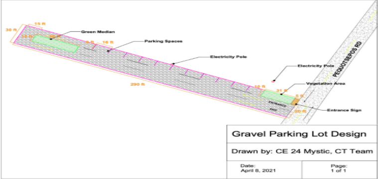
Figure 2
Team 24
Team Members |
Faculty Advisor |
Rayhan Al-Majahed |
Manish Roy Sponsor Town of Stonington, CT |
sponsored by

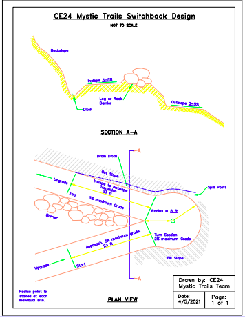
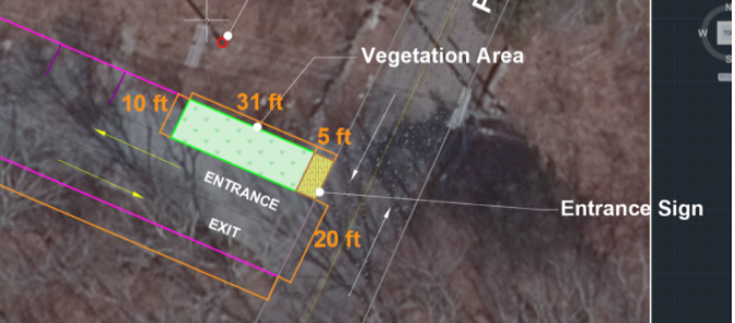
Our project's overall goal was to develop a network of off-road trails that would essentially serve as an alternative transportation network to link both the bicyclist and pedestrians in the town. We focused primarily on promoting access and commuter safety for non-automobile users while also establishing certain procedures that don’t interrupt the existing landscape. We advanced the prior recommendations made including specific trail locations, wetland and road crossings, trail signage, permitting, cost estimates, parking lot recommendations, and long-term maintenance considerations. Overall the goal was to create better access by building off the Eversource electric transmission line right of way that cuts through Denison Homestead property. To solve the problem of a lack of access, a simple yet effective solution could be bridging the gap between Pequotsepos Rd and the River to Forest Trail, as the Denison Homestead and Nature Center are easily accessible from near the road. In order to create access, a trail switchback following the path cleared out by the Eversource ROW could serve as this connector trail. In order to solve the problem of steepness, we designed switchbacks that would allow for a greatly reduced slope by using the zig-zag design. This ultimately allows for an increase in net trail distance allowing for an increase in accessibility to the walking path. A gravel parking lot off of Pequotsepos Rd would also contribute to access by allowing cyclists to park at either Coogan farm or the end of this proposed trail switchback. The close proximity between the two helps bridge any disconnect there may have been before. In addition to increasing the connectivity and improving the accessibility of the trail, we also designed a single unified system throughout the trail. These signs will allow for a better understanding of both the background of the trail and how all these locations interact with each other in terms of walkability, connectivity, and history.
